

Village
Pangpema - Kanchenjunga North Base Camp
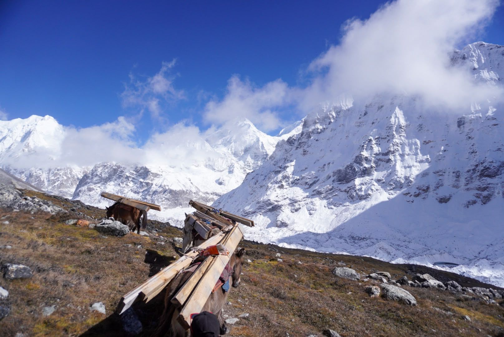
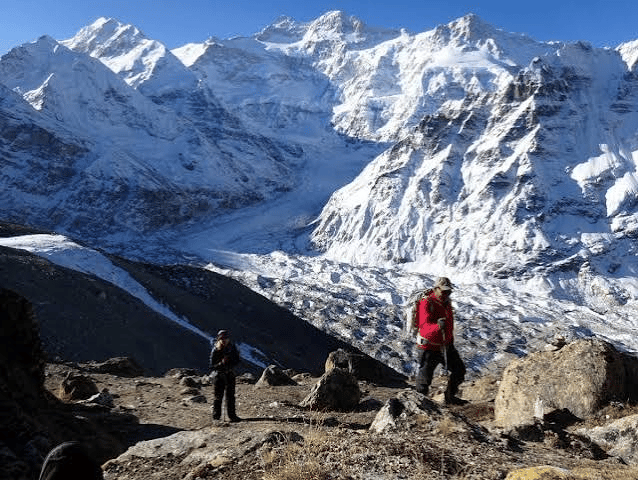
Pangpema, at around 5,140 m, is the northern base camp area of Mount Kanchenjunga. Reached from Lhonak through rugged glacial terrain, it offers spectacular views of Kanchenjunga’s northern face, glaciers and surrounding Himalayan peaks. Proper acclimatization is essential at this altitude.
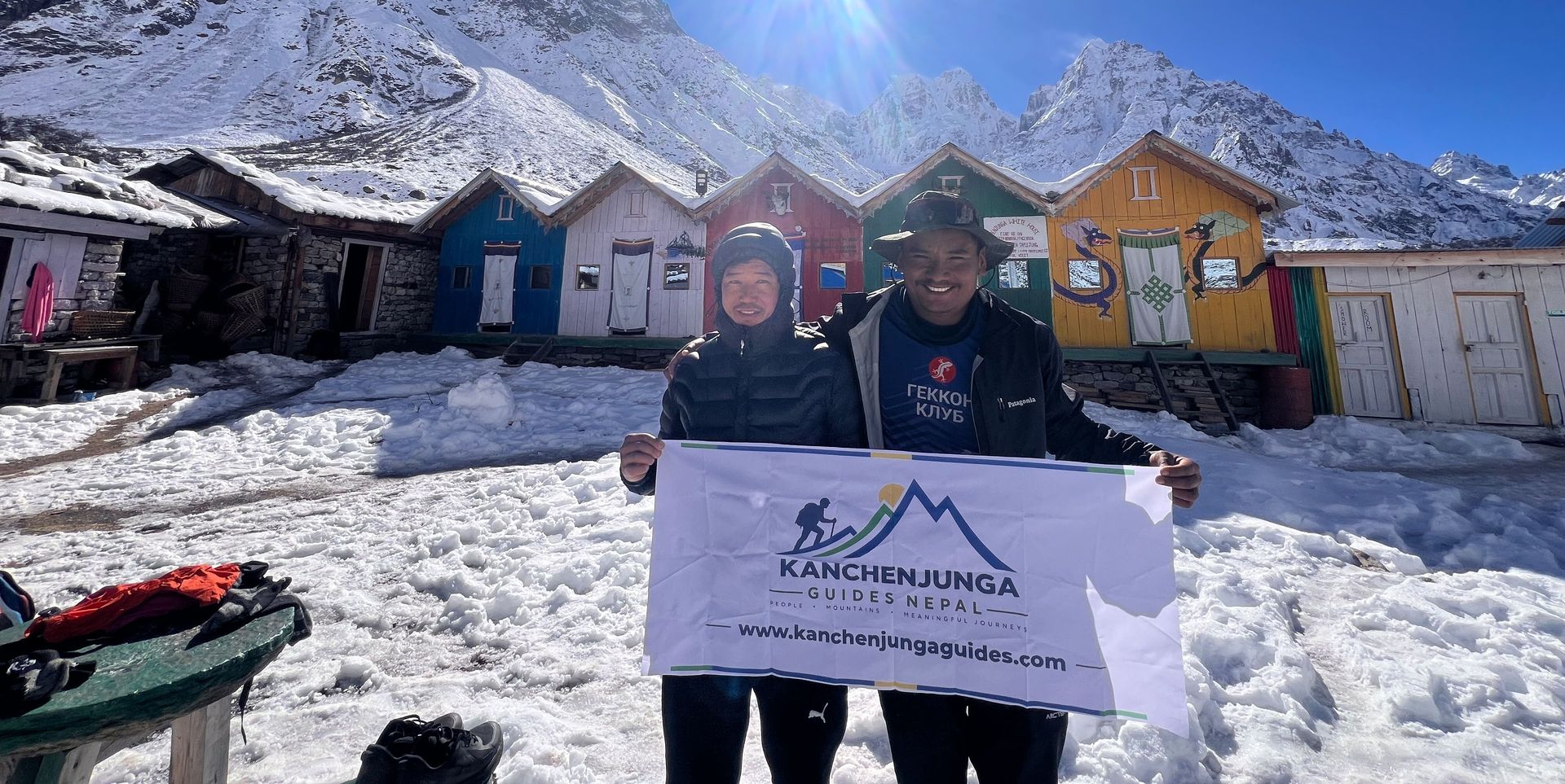
- Route: Kambachen → Lhonak → Pangpema
- Location: Kanchenjunga North Base Camp, Taplejung, eastern Nepal
- Elevation: 5,140 m / 16,864 ft
- Trekking Role: Northern base camp/viewpoint of Mount Kanchenjunga
- Mountain: Mount Kanchenjunga — 8,586 m
- Region: Kanchenjunga Conservation Area
- Landscape: Glaciers, moraines, rocky valleys and high Himalayan peaks
- Nearby: Lhonak, Kambachen, Kanchenjunga Glacier
Pangpema – Kanchenjunga North Base Camp
Pangpema is the northern base camp area of Mount Kanchenjunga, located at approximately 5,140 metres above sea level in the remote Himalayas of eastern Nepal. Surrounded by glaciers, rugged mountain valleys, and towering Himalayan peaks, it offers trekkers an extraordinary view of the north face of Mount Kanchenjunga (8,586 m), the world's third-highest mountain.
Reaching Pangpema is one of the major highlights of the Kanchenjunga North Base Camp Trek. The journey passes through traditional mountain settlements, high-altitude valleys, and increasingly rugged landscapes before reaching the glacier-carved terrain beneath the mountain.
Unlike the more developed trekking destinations in Nepal, Pangpema has very limited facilities and remains a remote wilderness destination. The high elevation and demanding approach require careful preparation, gradual acclimatization, and a well-planned itinerary.
For trekkers seeking dramatic mountain scenery and a quieter Himalayan adventure, Pangpema offers an unforgettable experience in the heart of the Kanchenjunga region.
Pangpema at a Glance
- Location: Taplejung District, eastern Nepal
- Region: Kanchenjunga Conservation Area
- Elevation: Approximately 5,140 metres
- Main role: Northern base camp area of Mount Kanchenjunga
- Nearby destinations: Lhonak, Kambachen, and Ghunsa
- Trekking routes: Kanchenjunga North Base Camp Trek and Kanchenjunga Circuit Trek
- Landscape: Glaciers, rocky moraines, high-altitude valleys, and towering Himalayan peaks
Where Is Pangpema?
Pangpema lies on the northern side of Mount Kanchenjunga in Taplejung District, eastern Nepal. It is located within the Kanchenjunga Conservation Area, a remote Himalayan landscape close to Nepal's borders with India and China.
The route to Pangpema follows the upper Kanchenjunga Valley. Trekkers usually pass through Ghunsa and Kambachen before reaching Lhonak, the last main overnight settlement before the North Base Camp excursion.
As the trail gains elevation, green forests and traditional villages gradually give way to open alpine valleys, rocky slopes, glacial moraines, and snow-covered peaks. By the time trekkers approach Pangpema, the landscape is dominated by rock, ice, and enormous Himalayan mountains.
Its remote location and dramatic surroundings make Pangpema one of the defining destinations of the northern Kanchenjunga trekking route.
The Trek from Lhonak to Pangpema
The journey from Lhonak to Pangpema is one of the most memorable and physically demanding sections of the Kanchenjunga North Base Camp Trek. Lhonak serves as the main overnight staging point, allowing trekkers to start early and travel toward the base camp area before returning along the same trail.
The route crosses rugged glacial terrain and rocky moraine, with increasingly impressive views of the surrounding mountains. Vegetation becomes scarce at this altitude, and the exposed landscape offers little shelter from changing weather.
The hike is commonly planned as a round trip of approximately 18–20 kilometres, taking around 7–9 hours depending on the exact route, conditions, and walking pace. These figures should be checked against the specific itinerary being followed.
Because the trail reaches more than 5,000 metres, it is essential to walk steadily, allow adequate time, and follow your guide's advice. Weather, fatigue, and altitude can all affect the journey.
After spending time at Pangpema and enjoying the mountain views, trekkers usually return to Lhonak for the night rather than staying at the base camp itself.
What Can You See at Pangpema?
The main attraction at Pangpema is the immense northern face of Mount Kanchenjunga. Rising to 8,586 metres, the mountain dominates the surrounding landscape, creating a remarkable panorama of steep rock walls, snow-covered ridges, and glaciers.
The wider valley features glacial formations, rocky moraines, barren slopes, and other high Himalayan peaks. The scenery is dramatically different from the forests and villages encountered earlier in the trek, highlighting the changes in the environment as you move into the upper mountains.
Clear weather can provide exceptional views of the Kanchenjunga massif and its surrounding peaks. However, cloud, snowfall, wind, and rapidly changing mountain conditions can affect visibility, so panoramic views cannot be guaranteed.
For many trekkers, reaching Pangpema is the defining moment of the northern route: a chance to experience the scale and remoteness of the Himalayas at the foot of one of the world's highest mountains.
Accommodation and Facilities Near Pangpema
Pangpema is a remote high-altitude destination with very limited facilities. It is not a developed village, and trekkers should not expect the range of accommodation and services found in larger Himalayan settlements.
Most itineraries use Lhonak as the overnight base for visiting Pangpema. Basic teahouses or lodges may be available at Lhonak, subject to seasonal operations and current conditions.
Before leaving Lhonak, make sure you have suitable warm clothing, waterproof layers, drinking water, snacks, essential medication, and any equipment recommended by your guide. Food options, charging facilities, and communication services are limited in this part of the region.
Your trekking agency can help confirm accommodation, meals, and the arrangements for the Pangpema excursion before your trip begins.
Best Time to Trek to Pangpema
Spring and autumn are generally the preferred seasons for trekking to Pangpema.
Spring (March–May) offers an opportunity to explore the Kanchenjunga region as temperatures become more favourable for trekking. Conditions can still be cold at Pangpema, particularly in the early morning and at night.
Autumn (September–November) often brings clear mountain views and favourable trekking conditions after the monsoon. It is a popular period for exploring the northern Kanchenjunga route.
Monsoon (June–August) can bring heavy rainfall, cloud cover, and difficult conditions on lower trails. Winter (December–February) can bring extreme cold, snowfall, and challenging conditions at high elevations.
Weather at Pangpema can change rapidly in any season. Check the forecast and local trail conditions, and follow your guide's advice when deciding whether it is safe to continue toward the base camp.
Preparing for the Pangpema Trek
Pangpema sits above 5,000 metres, where the reduced oxygen level makes trekking physically demanding. Proper acclimatization and a carefully planned itinerary are essential.
- Acclimatize gradually: Allow time to adjust to increasing elevation before reaching Lhonak and Pangpema.
- Walk at a steady pace: Avoid rushing the ascent, and follow your guide's recommendations for breaks and turnaround decisions.
- Pack for cold conditions: Bring insulating layers, a windproof and waterproof outer layer, gloves, a warm hat, and suitable trekking footwear.
- Stay hydrated and eat regularly: Carry sufficient water and snacks for the long excursion.
- Check the weather: Strong winds, snow, and poor visibility can make the trail more challenging.
- Recognize altitude illness: Headache, nausea, dizziness, unusual fatigue, or worsening breathlessness should never be ignored. Severe or worsening symptoms require prompt descent and medical assistance.
Pangpema is best approached with an experienced guide and a trekking itinerary that prioritizes safety over reaching the destination at all costs.
Experience Kanchenjunga North Base Camp
Reaching Pangpema takes careful planning, several days of trekking, and proper preparation for high altitude. Whether you prefer a dedicated northern base camp journey or a longer trek connecting both sides of Mount Kanchenjunga, choosing the right itinerary makes a difference.
At Kanchenjunga Guides Nepal, you can compare available trekking packages, trip durations, and group options to find the journey that suits your plans.
Explore North Base Camp Trek Explore Kanchenjunga Circuit Trek
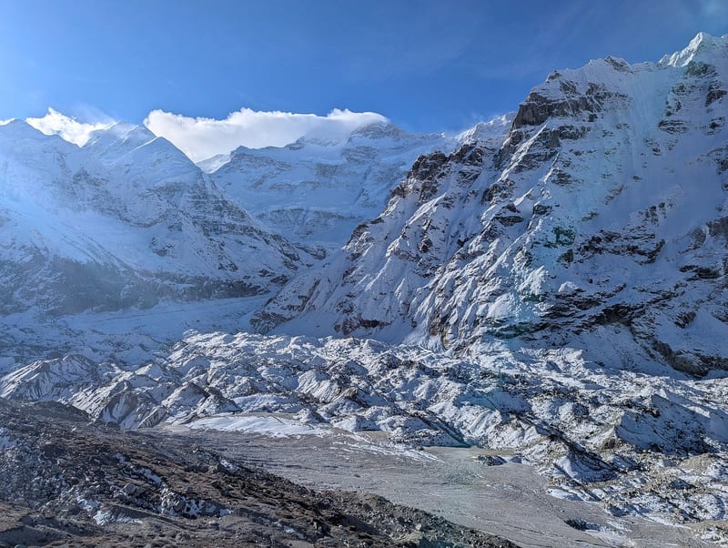
Or Full Circuit Trek (North + South)
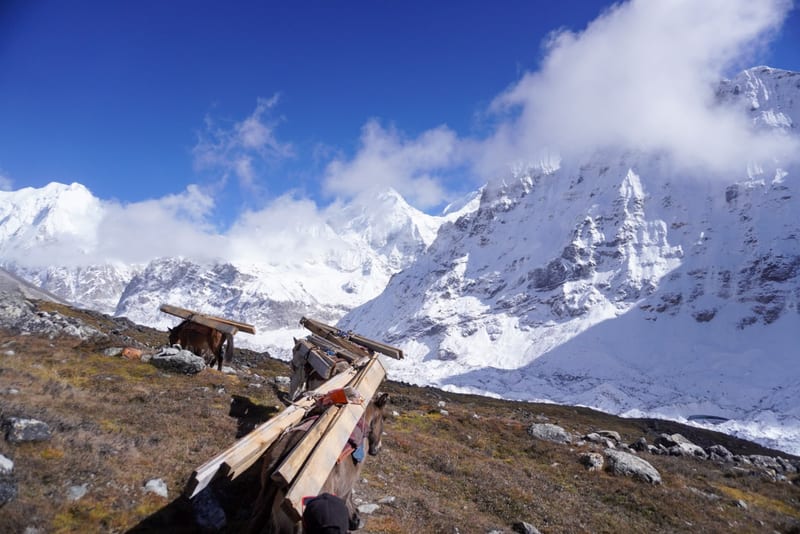
Frequently Asked Questions About Pangpema
1. What is Pangpema famous for?
Pangpema is famous for being the northern base camp area of Mount Kanchenjunga, the world's third-highest mountain. Located at approximately 5,140 metres, it offers spectacular views of the mountain's northern face, surrounding glaciers, and rugged Himalayan peaks.
2. What is the altitude of Pangpema?
Pangpema is located at approximately 5,140–5,143 metres (16,864–16,873 feet) above sea level. At this elevation, proper acclimatization and preparation for high-altitude conditions are essential.
3. How do you reach Pangpema?
Pangpema is reached on foot via the Kanchenjunga North Base Camp trekking route. The trail typically passes through Ghunsa, Kambachen, and Lhonak before continuing into the upper Kanchenjunga Valley toward the base camp.
4. How long does it take to trek from Lhonak to Pangpema?
The round-trip hike from Lhonak to Pangpema commonly takes around 7–9 hours, covering approximately 18–20 kilometres, depending on the route, weather, and walking pace. Trekkers usually return to Lhonak for the night.
5. Is accommodation available at Pangpema?
Accommodation facilities at Pangpema are extremely limited. Most trekking itineraries use Lhonak as the overnight stop before and after the Pangpema excursion. Basic teahouse or lodge accommodation may be available at Lhonak, depending on seasonal conditions.
6. What is the best time to visit Pangpema?
Spring (March–May) and autumn (September–November) are generally the best seasons for trekking to Pangpema. These periods often offer more favourable trekking conditions and opportunities for clear mountain views, although weather at high altitude can change quickly.
7. Can you see Mount Kanchenjunga from Pangpema?
Yes. Pangpema is renowned for its impressive views of the northern face of Mount Kanchenjunga and the surrounding Himalayan landscape. Visibility depends on weather conditions, so clear views are not guaranteed every day.
8. Is the Pangpema trek difficult?
Yes. The trek is challenging because of its high altitude, long walking days, remote location, and rugged glacial terrain. Trekkers should have suitable physical preparation, allow time for acclimatization, and follow a carefully planned itinerary with experienced local support.
9. Do I need a guide to trek to Pangpema?
The Kanchenjunga region has restricted-area trekking requirements, including guide and permit arrangements. Confirm the current regulations for your chosen itinerary and arrange the necessary support through a registered trekking agency before departure.
10. What should I pack for the Pangpema trek?
Pack warm insulating layers, waterproof outerwear, gloves, a warm hat, sturdy trekking boots, a headlamp, personal medication, water, and high-energy snacks. Your packing list should account for freezing temperatures, strong winds, and limited facilities at high altitude.
11. Can beginners trek to Pangpema?
Pangpema is a demanding high-altitude destination and is generally better suited to trekkers who are physically prepared for remote mountain journeys. Beginners should assess their fitness carefully, choose an appropriate itinerary, and trek with experienced guides and adequate acclimatization time.
12. Where can I book a Kanchenjunga North Base Camp Trek?
You can explore the Kanchenjunga North Base Camp Trek package on the Kanchenjunga Guides Nepal website. Compare the itinerary, duration, and included services to see whether it suits your travel plans.
Where is Pangpema - Kanchenjunga North Base Camp?
The exact point on the Kanchenjunga trail, with nearby places for context.
On this map
Nearby places
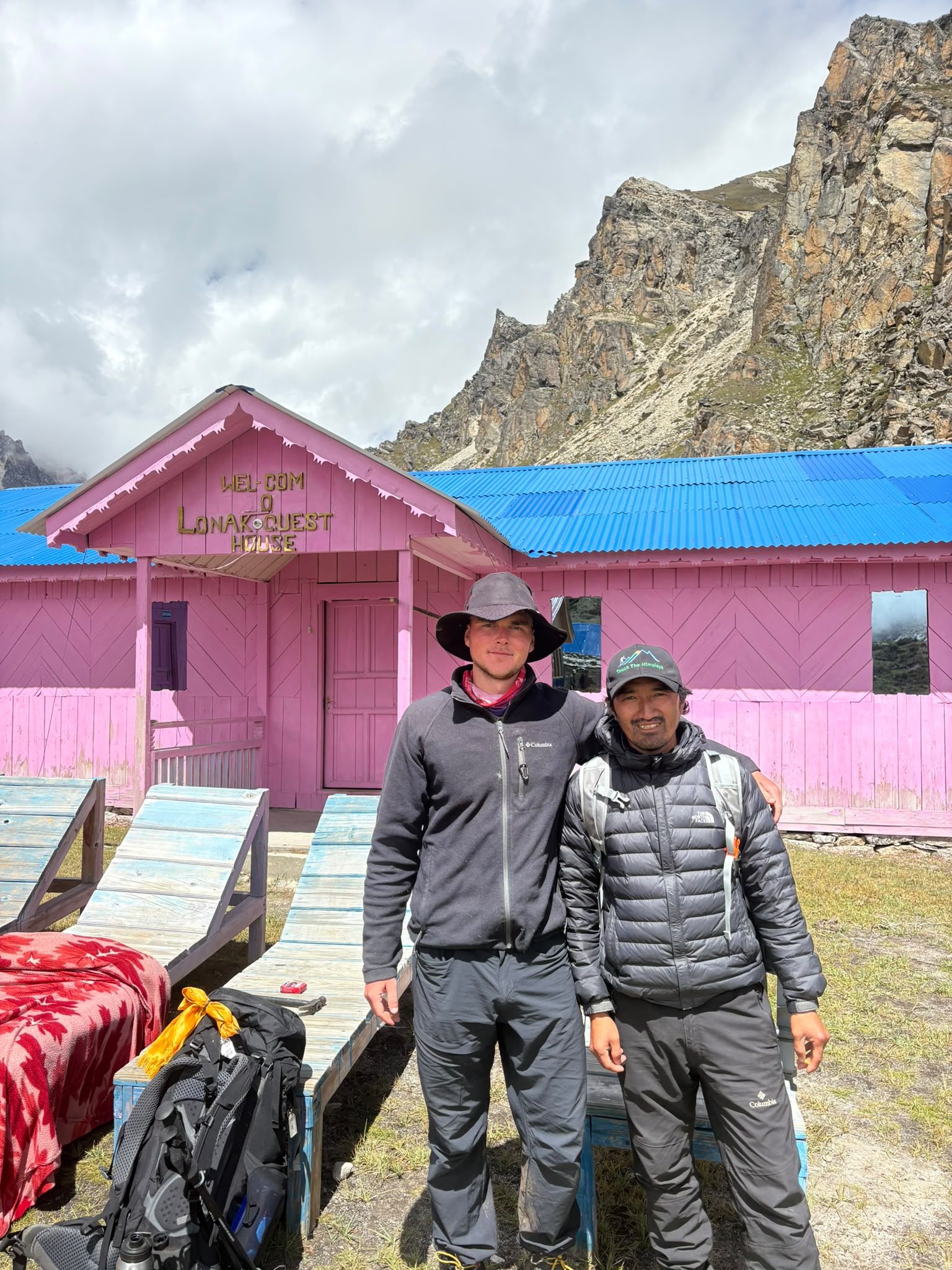
Village
Lhonak - Last Settlement Beneath Kanchenjunga
Lhonak – Last Settlement Beneath Kanchenjunga
4,780 m
Lhonak is more than a stop on the Kanchenjunga trek—it is the final high-altitude staging point before Pangpema, the North Base Camp. At around 4,780–4,790 m, trekkers are already in a demanding glacial environment, with very limited facilities and exposed terrain.
Read place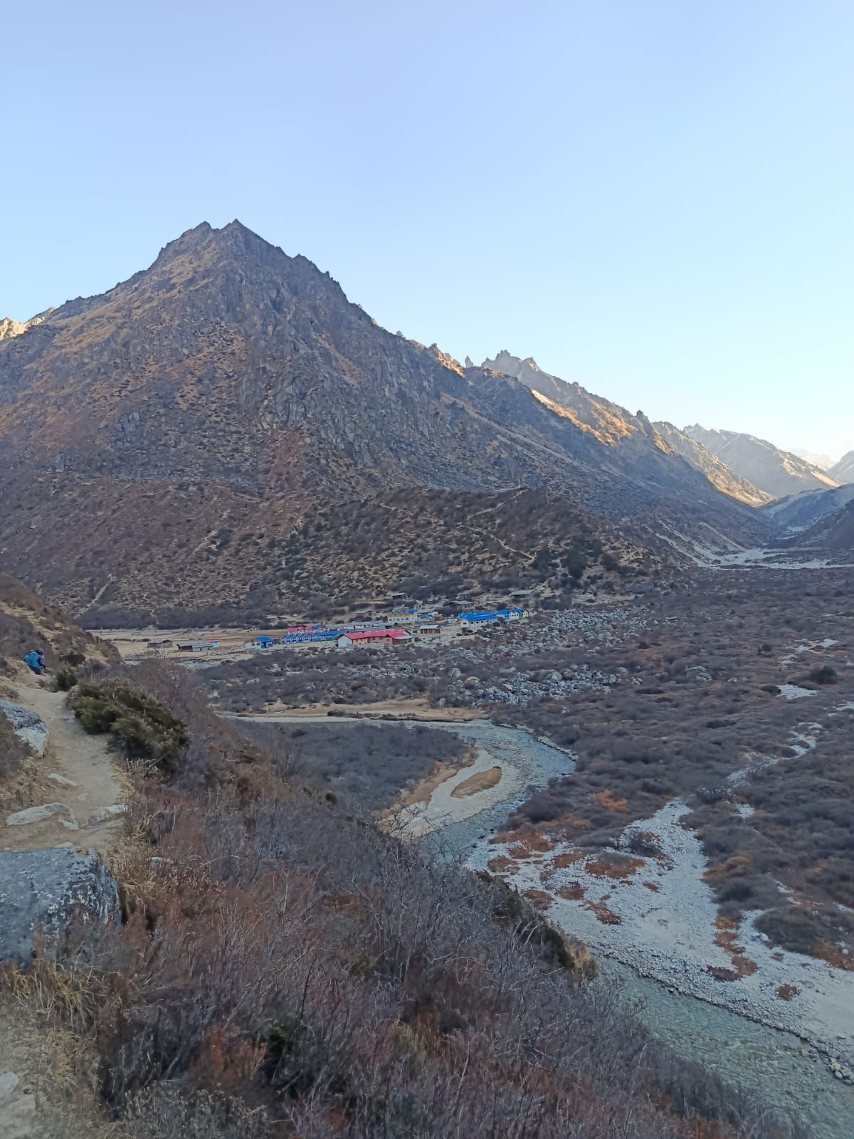
Village
Kambachen, Kanchenjunga
Khambachen
4,145 m
Kambachen at 4,145 m is a remote high-altitude settlement on the Kanchenjunga North Base Camp route, surrounded by dramatic alpine landscapes and views toward Jannu.
Read placeTreks that visit here
Related notes
Kanchenjunga Experiences
Ritesh KhadkaSeptember 7, 2026
The Kanchenjunga trek is more than a journey through the Himalayas—it is an experience of stepping into one of Nepal’s most remote, peaceful, and spectacular mountain regions. Far from the busy trekking routes of Everest and Annapurna, the Kanchenjunga region offers pristine forests.
Continue Reading
Kanchenjunga Base Camp Trek a Perfect holiday
Ritesh KhadkaSeptember 7, 2026
The Kanchenjunga trek is more than a journey through the Himalayas—it is an experience of stepping into one of Nepal’s most remote, peaceful, and spectacular mountain regions. Far from the busy trekking routes of Everest and Annapurna, the Kanchenjunga region offers pristine forests.
Continue Reading
Kanchenjunga Trek North & South Base Camps Itinerary
Madan NeupaneSeptember 1, 2026
The North & South Base Camp itinerary is a demanding high-altitude journey. Allow enough time for acclimatization and keep the schedule flexible for weather and trail conditions. Reaching both Pangpema and Oktang requires good preparation, appropriate equipment, and experienced local guides familiar
Continue Reading